 |
Puerto Rico |
How many of us can recall, upon learning that Puerto Rico is a United States "possession," a "commonwealth," thinking, "Well, why isn't it a state?" The obvious answer, of course, is because 50 states is such a nice number, and 51 is not. How would you get 51 stars on the flag?
Following a modicum of research, however, one discovers the true reason that Puerto Rico, taken by the U.S. following the defeat of Spain in the Spanish-American war of 1898 (The war that made Teddy Roosevelt and the Rough Riders famous, and the war that has the distinction of being the only American war in which more casualties were suffered because of disease than battle), is a territory and not a state: Puerto Rico doesn't want to be a state. Puerto Rico has no reason to want to become a state. Because Puerto Rico is in a strategic location should the Cubans ever stop rolling cigars and starving long enough to move aggressively against the U.S., the United States will maintain their presence on this Caribbean island, and so independence is probably a pipe dream. Barring true nation status, what could be better than being a U.S. territory? Consider: Puerto Ricans are American citizens, free to migrate back and forth with little more difficulty than, say, moving from South Dakota to North Dakota (though the P.R./U.S. move would require much more swimming and much less snow); Puerto Rico is under U.S. Customs laws, and so has no limits or tariffs on imports or exports between the island and the titanic Twinkie that is the continental U.S.; Puerto Rico is protected by the U.S. military from any warlike expansionist neighbors like Haiti or the Virgin Islands; and, best of all, Puerto Ricans do not vote in federal elections, and do not pay federal income tax. Imagine that: no blame can be laid on Puerto Rico for the idiocy of our elected leaders (and that is non-partisan biliousness, thank you), and their tax dollars do not pay for American imperialism. Indeed, as long as they have this level of official separation, Puerto Rico can claim to be a victim of American imperialism - and we all know how much fun that is.
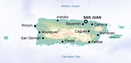
Let us delve deeper: Puerto Rico's climate is, of course, Caribbean; the temperature ranges between 73 and 78 degrees Fahrenheit all year long. Yet Puerto Rico, with 3.95 million residents in 3,500 square miles, has a higher average population density than any U.S. state, and higher than almost any country in the world - more than 1,100 people per square mile. And with 60% of the island covered with mountains, Puerto Rico has all of the joys of urban sprawl available in New York, Chicago, Philadelphia or Boston, without Northeastern winters - though there may be a few more hurricanes in Puerto Rico than in Baltimore. The Christmas season in Puerto Rico lasts from Thanksgiving Day until "Las Octavitas," eight days after Epiphany, or January 14. Children get presents both on Christmas Day and on Epiphany, the celebration of the Three Wise Men's arrival at Christ's bedside on January 6; on January 5, the night before Epiphany, children leave grass under their beds for the Three Kings' camels. How can other Americans live with themselves, after centuries of starving those poor beasts? Fie to your milk and cookies for the fat man in red!
Onward: the people of Puerto Rico are as fascinating as people anywhere, of course; but rather than worry about the deeper sociological implications of such a topic, let us simply discuss what we really care about - celebrities. Apart from the literary luminaries of the Nuyorican poets cafe, Jesus Colon and Miguel Pinero among them, Puerto Rico is the birthplace of golfer ChiChi Rodriguez, baseball Hall of Fame member Roberto Clemente, actor Raul Julia, musicians Jose Feliciano and Tito Puente, and quadruple threat Rita Moreno, the first woman to win an Oscar (for "West Side Story," of course, and what twisted mind could expect a page on Puerto Rico not to mention that film?), a Grammy, an Emmy, and a Tony award. It must be noted as well that the oldest man in the world, 113-year-old Emiliano Mercado del Toro, is a resident of San Juan. He took the title in January of 2005, and before May 29 of 2004, the world's oldest living person was 114-year-old Ramona Trinidad Iglesias Jordan. She lived in Puerto Rico as well.
The question, then, is not why Puerto Rico is not a state. It is why we haven't all moved to Puerto Rico.
© 1995-2008 Online Highways, LLC. All rights reserved.