 |
NevadaThe Silver State |
Nevada is named from the Spanish, meaning snow-capped. It is one of several states carved out of the Utah Territory, which was itself formed as a result of the Missouri Compromise of 1850. The Territory of Nevada was created in 1861, three years before it became the State of Nevada, in 1864.
In 1851 the first two permanent settlements in Nevada were established, one by Mormons at Mormon Station, now the town of Genoa, and the other by miners and traders at Gold Canyon, now called Dayton. Both Genoa and Dayton lay claim to being the first settlement; neither town will capitulate and the issue is still in question.
The area of Nevada, 110,540 square miles, makes it the seventh largest state. Each resident has lots of room to spread out (18 square miles per person) because Nevada's population is one of the smallest of all the states. The Census 2000 population count was 1,998,257.
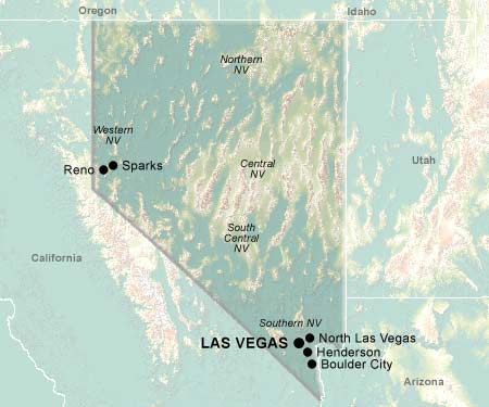
Nevada's capital has always been Carson City, first as the territorial capital and later as the state capital. The largest city is Las Vegas, enjoy an international reputation as gaming centers. Away from the neon lights of the city, Nevada is a starkly beautiful stateits arid midsection contrasting with the snow-capped Sierra Nevada mountain range on its western flank.
Natural wonders such as Gypsum Cave, Lunar Crater, Mouse's Tank, Lake Tahoe and the scenic Truckee River are jaw-droppers. State parks and recreation areas are interspersed throughout the state and include Washoe Lake State Park, Wild Horse State Recreation Area, Ward Charcoal Ovens State Historic Parkand Valley of Fire State Park. A "must see" is the state's only National Park, Great Basin National Park. For those who enjoy soaking in a hot or warm spring, the "Silver State" has over 300, the most in the nation.
Nevada is home to several colleges and universities including the University of Nevada Reno and the University of Nevada-Las Vegas. In addition, a bit of style and culture are manifested in the Guggenheim Museum and Kings Tut's Tomb and Museum.
© 1995-2008 Online Highways, LLC. All rights reserved.