 |
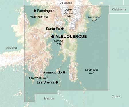
New MexicoThe Land of Enchantment |
Nobody knows for sure why the Anasazi disappeared in 1300 CE, leaving behind an architectural legacy of large communal dwellings erected on cliff ledges and atop mesas. Maybe it was crop-decimating climactic change that forced them from an stable agricultural existence into an uncertain nomadic lifestyle. Maybe it was conflict with outsiders such as the Navajo, or internal strife.
Or maybe the Anasazi were snatched by space aliens. This is New Mexico, after all, where a flying saucer crash-landed in 1947 near Roswell, disgorging a fatally injured, bulb-headed greenie who was subsequently dissected by military coroners. Of course US government representatives now claim that the spaceship was a high-altitude weather balloon, but such propaganda has been discredited through the dogged investigative efforts of the state's mammoth alien-exploitation industry... New Mexico: it's a mysterious, disquieting place -- whether it is space invaders, rabid conspiracy theorists hocking glow-in-the-dark trinkets, or the fact that 25% of the population is employed by the government which unnerves you the most.
And it's not just Roswell which seems unreal. The pure gypsum grit of White Sands National Monument seems too blinding, too white, too idealized, to exist in nature. The state's most famous outlaw is shrouded by controversy: was Billy the Kid left- or right-handed, did he kill five men or twenty, was he armed with a gun when that snake, Sheriff Pat Garrett, shot him in the dark? What is it that attracts so many New Age devotees to the state -- is it raw the organic beauty of the landscape, or some serene spirit which pervades everyone and everything? Why have so many artist colonies established themselves in Taos and Santa Fe?
Well... New Mexico, nicknamed The Land of Enchantment, is a beautiful, beautiful place. It's easy to understand why so many have been drawn there, for so many centuries... from so far, far away...
© 1995-2005 Online Highways, LLC. All rights reserved.